Monday June 26th was the final day of my mini four day vacation, which had been a lot of fun so far. Kate took the day off so we took the opportunity to have a day trip adventure.
We hit the road a little after eight in the morning after I dropped the kids off at the Boy's and Girl's Club where they would be spending their days this summer. Along the way to our first top in Fryeburg we hit construction on route 302 and were stopped on next to Moose Pond over looking Shawnee Peak.

We arrived at Weston's Farm & Market, located on route 113, which has been in operation as a farm on this land since 1799.


The market has a selection of local books and area specific souvenirs. The market has a few locally grown vegetables, meats, soda's, cheese, cookies, pies, pastries, and more. Off course during the harvest season they have even more. I bought a two molasses cookies that are made at the Mountain Side Bakery in Brownfield, we all loved them.

I also bought some cheddar aged 4 - 5 years made by the Yankee Cheeseman, it is fantastic! Their website is extremely basic only listing fairs he will be at where you can buy the cheese. It also says they will ship it, but the types of cheese and prices are not listed. The clerk said her brother or brother-in-law makes the cheese nearby in New Hampshire.
When trying to figure out where to go on a day trip I was looking at the map, we love the White Mountains, and route 113 winds back and forth between Maine and New Hampshire right through the White Mountain National Forest and as we hadn't driven it before it seemed like something we would like, and we did!

During my research I learned that a large section of the road is closed in the winter I couldn't find as to why but thought it can't be that bad. We've taken Vanna on some questionable roads in the past but this was a State Route so how bad could it be? When Kate saw the signs about road being closed in the winter she immediately questioned it. I summarized it couldn't be any worse than the Hemlock Bridge road that is dirt and closed in the winter.

We determined the reason the road is closed is because of the steep elevation climb when you are going North on it, and of course steep decline South. That as no one lives on that stretch it's not worth plowing it. Incidentally the road it paved enough for two car widths with little to no shoulder at times and its a beautiful drive.
There are several hiking trails along the road and it features the best Welcome to Maine sign I have ever seen!

We reached the top of Evan's Notch which has an elevation of 1,458 feet. Apparently water from there flows south to the Saco River and north to the Androscoggin River. There is also a grave marker or a memorial for Errold O Donohue who was a World War 1 veteran who died in 1963.


I can't find anything online as to why this marker is here, I do find it odd though being a National Forest that it is there.

Leaving the notch we continued north towards Gilead. Along the way Kate spied a footbridge that we turn around and visited. Spanning the Wild River from what I can find there was a previous suspension bridge located at this site.


Wesley took great joy running back and forth on it while Kate and I kept bringing him rocks that he could throw into the water below, something he takes great joy in.

Once we hit Route 2 in Gilead he headed into New Hampshire for lunch at Mountain Fire Pizza in Gorham. Kate had found this place on a list naming it the best pizza in New Hampshire and while it was delicious I couldn't rank it the best, that would be La Festa Pizza in Dover.


As I said though, lunch was quite good. We each got a small pizza, my standard pepperoni and she a Margherita. We also split an appetizer with french fries and scratch made mozzarella bites, they were excellent and the marinara sauce that came with them was also fantastic.
After lunch we headed back to Maine taking route 35 south once we hit Bethel. We stopped briefly in Lynchville to take a picture of the famous Maine sign naming towns with names of foreign countries and their distance from there. This sign has been on postcards for years. There is another on like it in China and another about twelve miles down the road in Norway.


Whoever owns the land next to the sign has decorated their yard with all kinds lawn ornaments and carvings, including a six foot tall Sasquatch!
Driving on route 118 to Norway we came upon Lake Pennesseewassee Park where we stopped as they sign showed swimming was available. I'm glad we stopped because they had a really nice little sand beach and the water beautiful. Wesley spent a good 35 minutes in the water, Kate and I waded in up to our calves.


Had the beach not been kid friendly they did have a two large areas withe playground equipment he could have used. He certainly appreciated being able to get out of the van and run around.
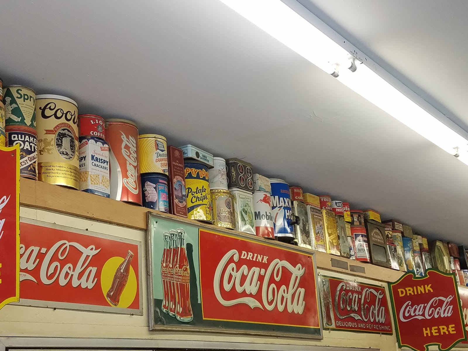
As I wrote earlier there was a sign similar to the one in Lynchville in Norway in the parking lot of The Lake Store. I went inside to grab a soda and I'm sure glad I did! The store is decorated all over with old signs, thermometers, tin cans, serving trays, and more. It's amazing! I snagged a lot of pictures. So glad I stopped in!


I attempted to find a bakery, Kate and I like to get a sweet treat on these trips and Wesley always likes a cookie! The two in the Norway area that I found were both closed, as a matter of fact a lot of stores were closed on Monday once we started looking.
I did find her a bakery but not until we got to Lewiston and Grants Bakery. I didn't know until after we left that she had never been there before. She got a chocolate and peanut butter roll slice, Wesley an M&M cookie, and I got myself the Whoopie Pie of the month, Lemon cake with lemon filling!

This was one of our shorter drives at just over 225 miles, but it was a wicked fun day! Not sure what's next for a day trip for us, however we are going camping in a couple weeks up in Calais for three nights with the kids! We can't wait!
Later Readers!